Twin Cities StoryMap
This AADN StoryMap reckons with the spatial contexts of the police killings of Philando Castile in 2016 and George Floyd in 2020 and investigates the structural role of the built environment in the Twin Cities.
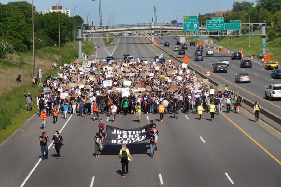
Thousands of protesters marched on Interstate 94 from St. Paul to Minneapolis in protest of the murder of George Floyd. The occupation takes on further meaning given that the freeway, which bisected the neighborhood of Rondo in the 1950’s, is just one example of infrastructure that contributed to deep-rooted racial injustice.
From the slicing of the Rondo and Near North neighborhoods (home to some of Minnesota’s largest concentrations of African American families) in two to the “racial cordons” of white neighborhoods around public resources, urban planning has sowed racial inequality in St. Paul and Minneapolis, otherwise known as the Twin Cities of Minnesota. This applies in countless U.S. cities, but as the region reckons with the events leading to the police killings of Philando Castile in 2016 and George Floyd in 2020, it is particularly urgent to acknowledge and investigate the structural role of the built environment in the fight for justice.
Use the scrollbar on the embedded StoryMap below to contextualize the racialization of space in the Twin Cities and learn about the pivotal impact of historic and contemporary Black designers along the way.
StoryMap Credits
The Twin Cities StoryMap was composed by Thandi Nyambose, student in the Master of Urban Planning program at Harvard Graduate School of Design.